Greenland Expedition: Navigating Glaciers and Moulins
Listen to the Expedition Greenland Update
Sign up for the Expedition Newsflash.
Receive alerts of new blog posts in your email during the expedition.
Day 2 of the Expedition across Greenland
Today was an exhilarating day during our expedition across Greenland. The morning started early; we got up at 7 AM and were ready to leave by 9 AM. After packing up the tent and having a hearty breakfast, we started our trek. Last night, just after recording my blog, we met the Ousland Explorers team. They had walked an hour longer than us and camped about two kilometers further on. It was a good landmark for us to walk towards. We saw them standing on top of a slope, walking back and forth. They were probably taking a break. Lower down the slope, we saw a tent with three people: the two Irishmen and the Norwegian who had sailed from Iceland to Greenland in a sailboat. Before we left, we had found a fuel bottle with gasoline that turned out to be theirs. We walked over to them, had a chat, and returned the fuel bottle. They were happy with their fuel, and we were happy with one kilo less weight in our sled.
The Route and Challenges
We noticed that the Ouslund Explorers team was walking more westerly than the ideal route. Using my GPS, we set our compass to a better route. It was not an easy trek; we had to navigate through several crevasse fields. Fortunately, the crevasses were clearly visible due to the rain and the temperature of 5 degrees above zero. This allowed us to safely walk from one starting point to the next without taking unnecessary risks. Our strategy consisted of walking for one hour followed by a break, which we maintained throughout the day. We started at sea level and reached an altitude of 780 meters today. That meant we had climbed over 600 meters with our heavy sled behind us.
Water Obstacles and Moulins
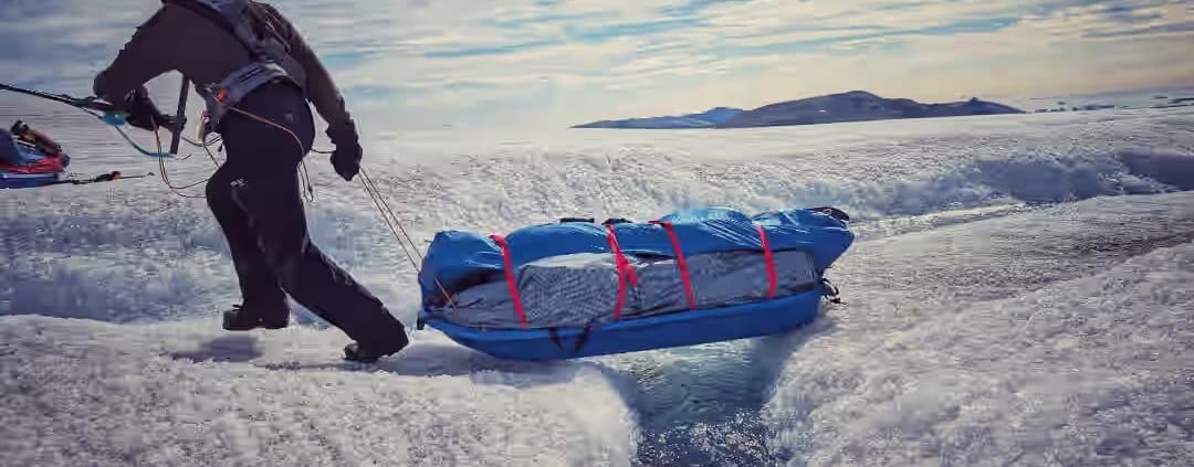
After the glacier fields, we came to horizontal terrain, but a new challenge awaited us there: water. Meltwater streams varied in width and depth, sometimes up to a meter deep. The water sometimes disappears suddenly into large holes called moulins, where it plunges in with huge waterfalls. This is frightening to see, because everything that disappears into it only comes out in the ocean. We kept a safe distance and took some photos before moving on. After all, we still have to reach the top of the ice cap at 2400 meters altitude.
Closing the Day
Today we walked seven shifts, each of one hour, covering 16 kilometers uphill. At six o’clock it started to rain as predicted by our Basecamp Manager and meteorologist. At a quarter to six we pitched our tents in the middle of a slope, which means we will probably slide a bit tonight. This was the update for day two of our expedition. We are going to eat something now and tomorrow a new day full of adventures awaits! Until then!


Leave a Reply
Want to join the discussion?Feel free to contribute!